Timberline Trail: Cloud Cap to Timberline Lodge (2020)
- Tina McLain
- Nov 19, 2020
- 10 min read

Updated: Aug 7, 2024
A one night backpacking trip of a section of the Timberline Trail in Mount Hood National Forest that I completed in 2020.

Start: Cloud Cap
End: Timberline Lodge
Access: Trail
Total Distance: 14.73 miles
Total Elevation Range: 4869′ to 7333′
Total Ascent/Descent: +3745 ft / -3733 ft
Number of nights: 1
Direction: Clockwise
Campsite: Near Newton Creek
Trail Type: Point to point
Outing Type: Backpacking Trip
Permits/Fees: Northwest Forest Pass required at parking lots and free wilderness permit at trailhead required for trail.
Location: Along the east side of Mt Hood in Mount Hood National Forest, Oregon, U.S.A.
Administration: Mount Hood National Forest
Ranger District: Hood River Ranger District
Wilderness Area: Mount Hood Wilderness
Other Posts: Timberline Trail, Timberline Trail: Timberline Lodge to Ramona Falls Trailhead 2020, Timberline Trail: Timberline Lodge to Ramona Falls Trailhead 2024
Dates: August 10, 2024 – August 11, 2024
After having done Timberline Lodge to Ramona Falls Trailhead as a day hike recently I decided to do my next section as an overnight backpacking trip from Cloud Cap to Timberline Lodge. It was my first solo backpacking trip which was quite the undertaking for me. I decided to do something easy since I was planning on doing a solo backpacking trip in the Wallowa's later in the summer, but due to some injuries and other things that happened I ended up not doing the Wallowa's backpacking trip.
The section of trail going out of Cloud Cap climbed to the highest point on the Timberline trail and this section had three stream/river crossings.
Day 1 - Cloud Cap to Newton Creek

Distance: 6.43 miles
Elevation Range: 5395' to 7336'
Ascent/Descent: +1625 ft / -2073 ft
Start time/End time: 12:30pm - 5:30pm
Time: 5 hours
Campsite: Near Newton Creek
Note: In 2020 at least, campsite areas filled up fast within Mt Hood Meadows so just something to be aware of.
Date: August 10, 2020
I woke up at 8:30am and got ready to leave. We drove to Timberline first and left the truck. Then we drove to Cloud Cap in the car. We got to the trailhead and my mom dropped me off. I started my hike 12:32pm. I was nervous because I was feeling tired, but I was also excited. The first section of trail was in tree cover, but it very quickly became barren. I started climbing uphill through scree and rock. I walked through an area with some small trees. I heard something running downhill towards me. I turned around just in time to see a deer dash right by me. I scared me pretty bad.
I was in exposed sun almost all afternoon. I climbed uphill for probably close to 3 miles. There were only 3 or 4 small snowfield patches I had to cross. Earlier in the summer there is probably a lot more snow. At one point I saw and heard an avalanche way up on one of the glaciers on the mountain. I saw chipmunks and birds occasionally. I could see Mt Adams, Mt Rainier, and Mt St Helens as I hiked uphill. I reached the highest point on the timberline trail, around 7300’ elevation. I thought there might be a view or something, but there wasn’t really.

After reaching the high point it quickly started descending downhill. As I was working my way downhill the trail passed through some pretty areas where there were purple flowers lining the trail. I could see Mt Jefferson and Three Sisters I suddenly came around a bend in the side of a hill and saw the trail neared a drop off. From that drop off was the most amazing view of the mountain! It reminded me of the view from Emerald Ridge on the first day of the Wonderland Trail. After that the trail continued down the bridge of the ridge. It was quite the drop down into the valley below. The trail dipped into some forest. It was pretty and quiet. There were pretty green meadows scattered throughout the open forest. The trail was really dusty and I couldn’t stop without inhaling a lot of dust.
I came to a trail junction. I saw a guy and girl come from the trail I was going to be continuing on. They said there were 2 logs across the creek upstream where they crossed over. I hiked downhill towards the Newton Creek crossing. There were some huckleberries along the trail that I munched on. When I came to the creek I had a hard time spotting the cairns or the logs across the creek. I spotted a guy up creek and he waved me up to him. When I got to where he was he was really nice and asked if I wanted a spotter. He was a really sweet older guy. He held my hand and we crossed the logs together. On the other side we chatted. He had gone ahead to find a campsite for his group. He told me all the campsites near Mt Hood Meadows were full. His group was going to camp on the other side of the river were we had come from and I decided I’d camp on the side we’d just crossed over to. There was a sheltered flat area. The guy went back to fetch the rest of his group and I set up my camp. I finished my day of hiking around 5:30pm. Five hours on the trail. I did a really good job taking care of myself. I went nice and easy. I would stop and take pictures. I made sure I was eating and drinking enough. I made sure I was taking breaks when I needed to.

I set up camp and started eating my supper. The guy and the rest of his group came by me and they all stopped and said hello. It was there first day out on the trail too. We had some really pleasant conversations and then they crossed over to the river to their camp. They invited me over to their campsite for the evening if I wanted. I was really worn out and decided I was just going to try and head to bed early. My feet were sore and I was nervous about my first night backpacking on my own. I was glad there were nice people nearby. I went outside my tent and got to see a beautiful sunset! The line along the horizon was sky blue, then above it was a delicious pink and light peach blended into a whitish blush. It was incredible. I’m not going to lie. I majorly psyched myself out and didn’t sleep well. I don’t really know how much I slept. I rested, but was on high alert. I also was wet fro sweating for overheating on and off all night. I was trying to make sure I didn’t get myself chilled because that would be bad. I don’t think I fully allowed myself to sleep until early morning. I fell asleep a little bit but kept waking up. At one point in the middle of the night it looked like a flashlight was being shined at my tent so I opened up my tent (I was guessing it was probably just the moon but I wanted to make sure) and it was the moon. It was at half it’s fullness, but was shining super bright. It was pretty and so were the stars.
Day 2 - Newton Creek to Timberline Lodge

Distance: 8.3 miles
Elevation Range: 4880' to 6020'
Ascent/Descent: +2333 ft / -1822'
Start time/End time: 7:25am - 1:20pm
Time: 5 hr 55 m
Date: August 11, 2020
I woke up at 6:20am. I changed into my hiking clothes, did some stretches, and then immediately started packing up my gear. I ate breakfast and then started hiking at 7:26am. I followed the trail which ended up climbing to the top of a ridge. It climbed to the top and then down the other side. The scenery was so incredibly beautiful! I ended up walking through a steep rock/sand field slope. I don’t understand how the trail doesn’t just slough away. I got the the bottom of the valley and had a creek crossing (Clark Creek.) This one was a bit trickier. There weren’t any great rock hopping places or logs across. I found a place that was a bit of a stretch, but I could step across some rocks that weren’t slick. I used my trekking poles to help balance me and was able to get to the other side. In hindsight it would have been safer to just walk across in the water instead of jumping between rocks.
The trail on the other side started climbing uphill. There were beautiful fields of flowers on the side of the hill. I came to a beautiful small waterfall. It looked like a place fairies would live. Neon green moss lined the water and a blanket of flowers framed the sides of the moss. I filled up with water there and then kept hiking. Around the next corner was another waterfall that was a lot bigger and required a stream crossing. There were rocks I was easily able to hop over just slightly upstream.
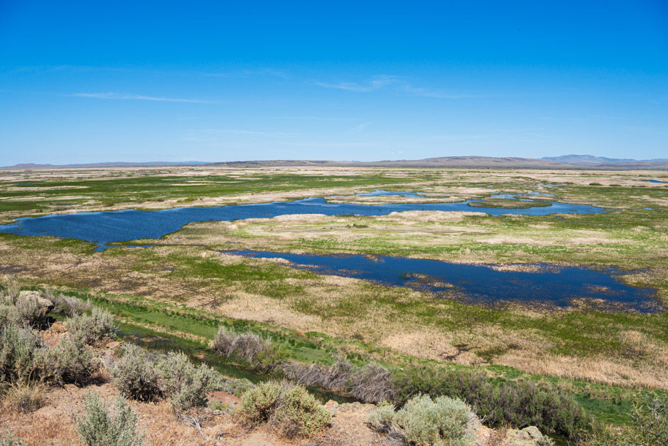
At the top of the next ridge I descended into Mt Hood Meadows. There really are meadows full of wild flowers! I didn’t run into as many people as I thought I might in this section. There were a lot of ups and downs in the trail. I munched on some huckleberries along the trail and passed under ski lifts. I ended up hyperextending my left knee through a semi-overgrown section of trail. I was like “oh shit” in my brain and worried it would make it difficult to continue onwards. It hurt, but wasn’t limiting thank goodness (NOTE as of November 4th when I’m writing this - that stupid knee is still giving me issues and made it so I wasn’t able to do a backpacking trip in the Wallowa’s in August lol).

At the end of Mt Hood Meadows the trail started to quickly descend and went into a heavily forested area. The switchbacks got steeper the closer I got to White River. The trail, once I reached the bottom of the valley and river area, was lined on each side with a rock pathway leading up to where the first arm of the river crossing was. There ended up being two veins of the river I had to cross. There were no logs or rocks to walk across. I put on my sandals and secured my boots to the back of my backpack. The water was ice cold and had a strong flow. I found the safest spot to cross and then I took it slow and easy. Just one step at a time, making sure I was solid and balanced with each step. The water came up right below my knees on the deepest section of the crossing. Then I had to walk a ways over rocks and sand to the other vein of the river. This vein had an 8-10 ft embankment along each side of the river which was too steep to climb down or up. I walked up stream a ways to where there was a waterfall and it was only 4-5 ft (and not as steep) down to the water. I was able to take only 2 large steps in the water to cross this time and it didn’t come up as high on my legs, it didn’t even hit mid calf.
Once I got to the other side of the second crossing I rinsed my feet off and put my boots back on. I took a short break on the river’s edge. I’d been so focused on crossing the river I hadn’t even noticed the amazing view of Mt Hood right in front of me. I just ate my food and took in the scenery.
I was able to find the trail on the other side of the river pretty easily. It was an all uphill climb from White River to Timberline Lodge. The trail climbed up to the top of the ridge where it met up with the PCT (Pacific Crest Trail). Then the trail followed the top of the ridge. The trail got really sandy. The sides of the steep slopes on either side of the ridge were made of loose dirt/sand. The wind would whip up the side of the slopes and would gust across the top. It would get in my eyes and when I’d breathe in it felt like I was sucking in dirt. I continued my slow uphill hike in the sand. There was only one short hill section with sand where I was sliding two steps back for every step I took forward. Thankfully there weren’t any more sections like that. There were some pretty views of White River and the valley below. It was crazy to see how far I’d climbed up from where I’d been. I made it to the “top” of the ridge near Timberline Lodge. I had one last easy stream crossing and then I came out on the PCT/Timberline Trail above Timberline Lodge. My feet and knee hurt. I was tired, but I didn’t fully feel it because I was so excited and proud of myself. My first solo overnight backpacking trip. I did it! I felt euphoric.
Gallery
River Crossings
The conditions of river crossing change each year and by each season. There are no “bridges” across any of the river/creek crossings on the Timberline Trail. My pictures and descriptions only show what it was like for me. It could be very different even a day later from when I crossed. I’m sharing the photos and descriptions because I feel like it at least gives an idea of what the river crossings are like.
Newton Creek

WA1 - A dry crossing is possible by using rocks or logs.
*Would be a WA4 without log.
Difficult. Current very strong. Two smaller logs across creek to walk across.
Clark Creek

WA2 - Possible wet crossing, but a dry crossing can be accomplished with some finesse.
Sketchy rocks across. Would have been safer to walk across in water.
White River


Vein one - WA4 - Wet crossing, calf- to knee-deep.
Vein two - WA3 - Wet crossing, ankle- to calf-deep.
More difficult. Two veins of the river. First vein was wide and strong knee height water. Was able to walk across both veins in water.
Resources
Map Resources
FarOut now has a Timberline Trail map. When I did this trip in 2020 there was no map with condition updates for this side of the Timberline Trail, but now there is!
Trail Planning Resources
Map
My Wild Adventure is not responsible for your safety, any possible injury, or anything that happens if you choose to follow anything on this website. Maps are not intended to be used for navigational purposes, but to give an overview of the route taken. By going outdoors you are solely responsible to know your strengths and limitations, be aware of current conditions and proceed with the appropriate caution. My Wild Adventure is not responsible for your choices and the outcome. Reference my disclaimer for more information on being responsible outdoors.