OCT: Segment 9 — Sand Beach to Nestucca Bay
- Tina McLain
- May 20, 2024
- 10 min read

Updated: Jan 12, 2025
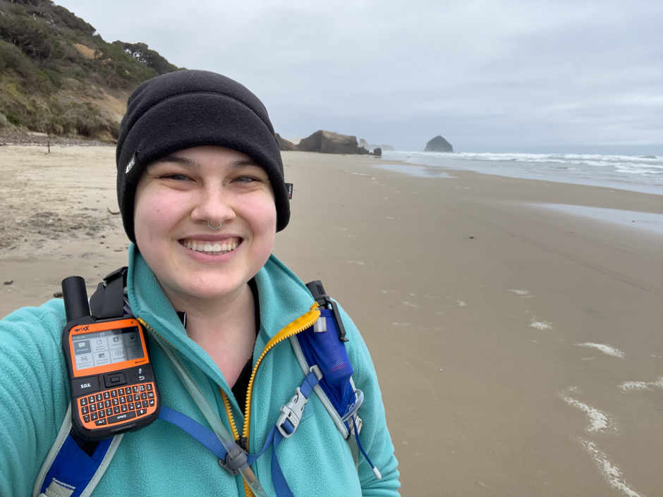
A north-central segment along the Oregon Coast Trail from Sand Lake Recreation Area to Bob Straub State Park Day Use Area.

Segment 9 of the Oregon Coast Trail spans the north-central coastal area from Sand Beach to Nestucca Bay. It passes through Tierra del Mar and Pacific City. This section encompasses Sand Lake estuary and OHV area, Sitka Sedge State Natural Area along Sand Lake estuary, Sandy Plover nesting areas, McPhillips Beach, Cape Kiwanda State Natural Area, Great Dune Peak, Kiwanda Beach, and Bob Straub State Park. I did this segment in three parts: two as driven sections and one as a section hike. I also added on hiking the Nestucca Spit in Bob Straub State Park.
The Oregon Coast Trail spans 362 miles (according to Oregon State Parks) or 425 miles (according to the Oregon Coast Trail Foundation) of the Oregon Coast from the Columbia River in the north to the California border in the south. The trail still has "gaps" in the trail that are road walking sections along highways and roads until more trail can be made. The Oregon Coast Trail Foundation works to maintain and expand this interconnected trail system. This long distance trail can be done as day hikes, section hikes, or a thru-hike. There are many ways to recreate and experience this trail and the beautiful coastline it entails.
Blue - driven section | Pink - hiked section
Explore by section:
My Section Hiking Approach
The Oregon Coast Trail is technically incomplete and the road walking sections are "gaps" in trail where no trail exists. So, I decided to do the road sections by vehicle instead of walking on the side of Hwy 101 or other roads that I feel unsafe doing. As more trail is established, I plan to come back and do those sections that were previously road sections. I also plan to add on sections such as capes, spits, and peninsulas to hike as much beach as possible on the Oregon Coast. Some sections I'll do as out and back, round trips when I head out alone and other sections I'll go north or south in a point-to-point hiking style. My intention with section hiking is to cover the Oregon Coast regardless of direction. I don't feel a need for my section hiking to be in a certain continuous direction. I will be trying to do as much of it as possible in a southward direction to avoid winds hitting my front, but besides that my goal is to cover all of the Oregon Coast trail, regardless of how I do it or in what direction. Obviously do whatever feels right for you on your own section hike. My reason for being out is to enjoy exploring and work toward finishing this long-distance trail in a way that works best for me and my body.
A note on how I classify "segments"
The number segments of the Oregon Coast Trail are loosely set and based off of the Oregon Coast Trail Foundation maps. Instead of rigidly following the exact start/end of a segment I'm basing my start/end based off of my start/finish of a certain driven/hiked section.
For example: Segment 9 technically starts at Sand Lake Beach, but that's in the middle of a hiking section. So, I moved the "start" for Segment 9 to Sand Lake Fisherman's Area since that's where the start/end of certain hiked/driven sections start for me. I'm not going to break my hiked or driven sections in half so it fits precisely within a segment. So there may be some overlap between different segments due to that.
Each post I make will be for a certain segment and within that post it will be broken up into sections with in it that I drove or hiked. I will list each section from north to south regardless of which direction I hiked it so everything is in a cascading order.
Sand Lake Fisherman's Day Use Area to Sitka Sedge State Natural Area

Mode of access: Vehicle
Access: Road
Direction: South
Distance: 6.1 miles
Date driven: March 21, 2024
I decided to drive this section since I was doing it at the end of March and the Sand Lake Estuary entrance is only passable at low tide during the summer. So I drove the alternate route from Sand Lake Recreation Area to the trailhead for Sitka Sedge State Natural Area. The drive is pretty and circles around the estuary and passes Whalen Island. Sitka Sedge is beautiful and I'm glad I got to explore it with doing this alternate route. Definitely worth the extra miles.
Sitka Sedge State Natural Area to Bob Straub State Park

Mode of access: Hiking
Access: Trail, Beach
Direction: South
Distance: 10.5 miles
Points of Interest: Sitka Sedge State Natural Area, Cape Kiwanda
Date hiked: March 19, 2024
I was pretty anxious about doing my first section of the Oregon Coast Trail. It was my first real test of what my body was capable of at that point. The dissociation I experience had been pretty intense in the days leading up to the hike. Like my mom kept telling me, "it's okay to do things regardless of whether you feel real or not. It's okay to hike and not feel real." I almost bailed right before starting, but had enough determination to at least try. And try I did.

I started at the Sitka Sedge State Natural Area and took the Beltz Dike to the beach trail. I got a little mixed up and accidentally took the Kinnikinnick Woods Loop trail instead. I was so confused before the trail to the beach lead directly to the beach, so the ocean noise should be coming from in front of me. But since I was traveling on a trail that went south and parallel with the beach I was hearing the ocean to my right. So I stopped and evaluated my map and realized I took the wrong turn at the last trail intersection. So I backtracked and took the right trail which lead me directly to the beach. I got there around 5 minutes before the peak of high tide. High tide on the day I did this was at 9:29am (5,4ft). The beach was wide enough that after watching the ocean for a few minutes I felt safe enough to walk on it.

I headed north to where the beach met the Sand Lake Estuary. This is a Snowy Plover restriction area so I made sure to stay to the wet sand and to the west of the signs. It was very overcast and gloomy. There was a bit of wind but nothing terrible. I went north until I was able to look across the estuary to Sand Lake Fishermans area to the NE and could see back into the estuary to Beltz Dike to the SE. I turned back around then started my hike south down to the beach to Tierra del Mar. I only came across two other people and their dog as I made my way to Tierra del Mar.
As I got closer to Cape Kiwanda I started to see a lot more people. As I neared McPhillips Beach after passing through Tierra del Mar I came across a few cars on the beach. There was a rock outcropping right before McPhillips Beach that I had to climb over since the tide wasn't far enough out to go around. It was easy and not risky. I continued my hike down McPhillips beach to Cape Kiwanda. Then I climbed up the sandy slopes of Great Dune (peak) on Cape Kiwanda. It was one step forward, two steps back hiking up the steep sandy slope. My quads were burning and on fire by the time I reached the top. I found a place to sit and eat my lunch a few feet below the peak on the south side looking out out over Pacific City. Surprisingly this area had very good T-Mobile coverage so I checked in with my family while eating my couscous for lunch.
I'd already hiked 6.5 miles at this point. I decided to explore some of Cape Kiwanda since the last time I was here was in 2017. Cape Kiwanda has changed and eroded in some visible ways since then. I climbed partially down and explored the western fenced sections. Then I started my trek down Kiwanda Beach alongside Pacific City. I stopped a few times since my feet and back were starting to hurt pretty good.

As I neared Bob Straub State Park my mom told me her work meeting got done early and she could come pick me up early unless I was wanting to do more trail. I decided with how much I was hurting that I'd have her come pick me up. I hiked down the Bob Straub Beach and then cut across to an inland trail (big mistake) OMFG I walked a half mile in loose, deep, dry sand. My legs were on fire and I was pretty much cursing internally the whole time. I would have been better off walking the beach back. The dunes were pretty even if my quads disagreed. I made it to the Bob Straub State Park day use parking lot where my mom picked me up.
We stopped by Pelican Brewery in Pacific City to celebrate me hiking my first longer section of the OCT. I got some onion rings and their house-made root beer. I plan to come back with my sister and try their hard cider at some point. My body really hurt, I think the last section in the dry sand is what really did me in.


I found this section of beach to look very similar. There were some small variations, but overall it felt the same. I think it's mainly between Tierra Del Mar and McPhillips Beach where the tide needs to be taken into consideration, but there's no major "low tide only" parts in this segment, unless you're crossing Sand Lake Estuary entrance at low tide in the summer instead of taking the alternate route around. From Tierra del Mar to the north side of Cape Kiwanda vehicles are allowed on the beach. On the south side of Cape Kiwanda it's only the Dory fisherman whose vehicles are on the beach.
ADD ON: Bob Straub State Park — Nestucca Spit

Mode of access: Hike
Access: Beach
Direction: Round trip
Distance: 5 miles
Date hiked: May 3, 2024
I decided to hike this on a very overcast day. I started at 10:25am, high tide had been at 9:24am so the tide was going out while I was hiking. The tide ranged from 4.7 ft - 2.8 ft during my hike. I parked in the Bob Straub State Park Day Use parking area and hiked over the dunes to the beach entrance at Beach Access 37B. As I neared the top of the dunes I saw a doe to the south. It was a surprise to see a deer.

I hiked south down the beach toward the end of the spit. I found a few whole sand dollars and some other cool shells as I made my way down the beach. I was able to hike for a half mile before it started to rain on me. So I stopped and put my rain gear on and then kept hiking. Since the weather wasn't that great I had the beach all to myself — didn't come across anyone else the rest of the time.
The dunes that butt up against the beach are pretty cool since they are almost cliff like ledges due to the erosion. It has a different feel than other beaches in the area and is in a lot of contrast to the dunes up near Sand Lake Recreation Area that are more rolling.

As I got within a half mile of the end of the spit I saw some heads poking up periodically in the water. It was harbor seals watching me! I neared the end of the spit and came to the inlet for Nestucca Bay. The forest on the other side of the bay was gorgeous. There was a huge mansion on the other side of the inlet.
Once I went to the point I was planning to turn around I stood for a bit and watched some cormorants fish and then started to see numerous heads popping out of the water. A whole herd of seals were in the water not that far from the beach. They were swimming and fishing in the inlet currents. They were rather curious little guys and kept watching me. It was still raining so I only used my phone to take a few pictures and videos, so not great quality. It was the highlight of my hike.

The rain started coming down heavier on my hike back. There was a south wind that got stronger so I was getting pelted by the rain and wind against my back. I hadn't stopped to put my rain pants on so my pants were pretty wet by the time I finished my hike. My calves were coated in sand from the wind. I will definitely take the time to put my rain pants on in future hikes.
I ended up driving back to the apartment we're staying in and taking a hot shower followed by a warm drink to warm up. It was a fun hike. Felt a bit monotonous sometimes with the weather and flat beach hiking, but I enjoyed it nonetheless. Would totally do it again for even just a chance to see the harbor seals. I intentionally chose not to take any of the inland trails since they're all dry sand and that kills my quads.

My Wild Adventure is not responsible for your safety, any possible injury, or anything that happens if you choose to follow anything on this website. Maps are not intended to be used for navigational purposes, but to give an overview of the route taken. By going outdoors you are solely responsible to know your strengths and limitations, be aware of current conditions and proceed with the appropriate caution. My Wild Adventure is not responsible for your choices and the outcome. Reference my disclaimer for more information on being responsible outdoors.


