Multi-Lake Hike Along Thomas Lake Trail #111
- Tina McLain
- Nov 3, 2025
- 5 min read

A multi-lake hike in Indian Heaven Wilderness in Gifford Pinchot National Forest.

Access: Trail
Distance: 2.47 miles (round trip)
Elevation Range: 4077' to 4326'
Ascent/Descent: +226 ft/-205 ft
Trail Type: In and out
Trails: Thomas Lake Trail #111
Outing Type: Day hike
Permits/Fees: Northwest Forest pass or equivalent is required for parking. Free self-issue wilderness permit required (at trailhead kiosk).
Notes: The trail that loops around Thomas Lake is somewhat overgrown
Location: On the west side of Indian Heaven Wilderness in Gifford Pinchot National Forest, Washington, U.S.A.
Administration: Gifford Pinchot National Forest
Ranger District: Mt Adams Ranger District
Area: Indian Heaven Wilderness
Date Accessed: August 15, 2025

After having done a few day hikes in the area I decided to check out the Thomas Lake Trailhead. There were a few cars there, but it was by no means overflowing. It was rainy, overcast, and foggy but I'd already been out hiking in the rain so it wasn't a deterrent for me. After I filled out the free wilderness permit at the trailhead I started on my hike.
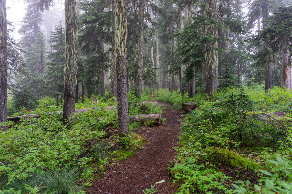
The trail gradually went uphill with tall huckleberry bushes and undergrowth lining the it. Then started climbing a bit more steeply uphill with a switchback before gradually climbing uphill until it flattened out near the lakes.

Lake Name: Thomas Lake
Lake Coordinates: 46.00328, -121.82928
Lake Elevation: 4308'
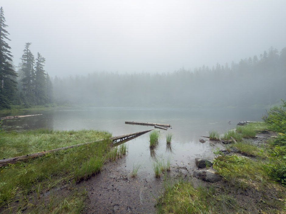
Dee Lake was the first one I was able to spot through the trees, shortly followed by Thomas Lake. I decided tot take the loop trail around Thomas Lake which ended up being very overgrown. With the weather being what it was, it created such a cool feel and look to the lakes with fog partially obscuring them. Since the trail was overgrown and it was raining, my rain gear got drenched since all the plants were very wet and I was having to push my way through them.

Lake Name: Lake Kwaddis
Lake Coordinates: 46.00072, -121.83100
Lake Elevation: 4311'
On the far end of Thomas Lake the trail passes between Thomas Lake and Lake Kwaddis. I took a rocky, dried up stream bed to the edge of Lake Kwaddis so I could see the lake and take some pictures. It was stunning. Turns out a few feet further up the trail was a spur trail to the edge of Lake Kwaddis, so hiking the dried stream bed was unnecessary.
The forest throughout this whole area was so quiet. I wrapped around the east side of Thomas Lake and came across the only people I was on m hike, one group camping and one group hiking along the lake.

Once I got back to the Thomas Lake Trail #111, I headed east up the trail so I could see the other lakes in the area. I took a spur trail to Heather Lake & Eunice Lake.

Lake Name: Lake 46.00449, -121.82746
Lake Coordinates: 46.00449, -121.82746
Lake Elevation: 4321'
Initially I thought a small pond might be Heather Lake and was confused that there was no trace of a trail to it and that it was so small. Lol. turns out Heather Lake was the bigger lake behind it. I couldn't tell if the pond was connected to Heather Lake or its own little lake. It was really cute and pretty though. (I'm noting it as Lake 46.00449, -121.82746).

Lake Name: Heather Lake
Lake Coordinates: 46.00501, -121.82791
Lake Elevation: 4311'
I took another spur trail that said it lead to "campsite #6" which appeared to be near Heather Lake. I wanted to see if there was a way to access the edge of the lake for a photo. There were a few blow downs I had to climb over, but the trail was visible clear to the campsite which was empty. There was a foot path that lead down to the lakes edge. I discovered later that Heather Lake is fully visible from along the Thomas Lake Trail #111, so hiking to this campsite isn't necessary to see the lake.
Lake Name: Eunice Lake
Lake Coordinates: 46.00513, -121.82477
Lake Elevation: 4324'
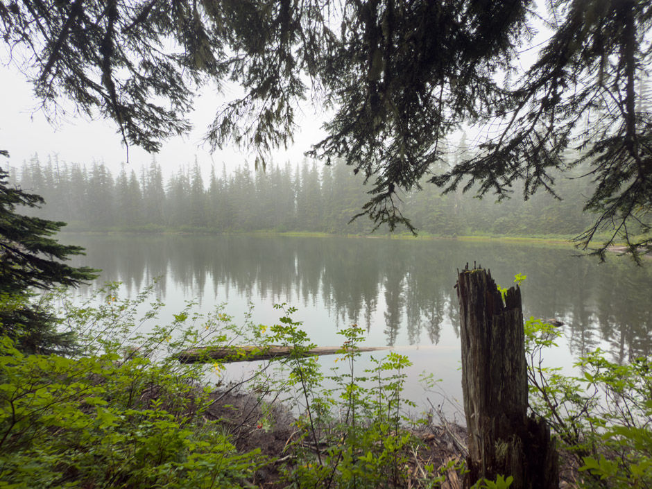
I continued down "unmaintained" trail to Eunice Lake, there was a short little spur trail that lead to the lakes edge. there were small frogs hopping about all across the ground. Once again, I was in awe of how beautiful the lake was and how quiet the forest was in the rain.
Lake Name: Dee Lake
Lake Coordinates: 46.00531, -121.82997
Lake Elevation: 4324'
I then decided to head back towards the trailhead, so i took the Thomas Lake Trail #111 on the way back and got to hike the section that goes along the north side of Thomas Lake. Turns out Heather Lake was visible from along the trail, so as I mentioned above, it wasn't necessary to hike to the campsite to see the lake.
A little further along, there was a short spur trail that went down to the edge of Dee Lake. It had a really great view of the lake and it was a nice, pleasant surprise to not have to bushwhack anywhere in the rain.
All the lakes were so quiet and peaceful. I guess the rainy weather really deterred a lot of people because this is supposedly a popular spot. I didn't mind the rain. I loved the foggy, misty look the forest got and it it also held off the hoards of mosquitoes! So I made it through the hike with no bites. Only meh part was with the trail being overgrown around Thomas Lake, even with my good rain gear I still got wet, and my shoes were a completely soggy, soaked mess. Regardless, it was quite the fun adventure.
Beyond just the lakes, the forest in and of itself was stunning with all the green undergrowth from the huckleberry bushes and the open forest feel. I don't think I could pick a favorite lake since they all had a similar feel with just small differences.
Coordinates
Trailhead: 46.00580, -121.83912
Thomas Lake: 46.00328, -121.82928
Best view of Thomas Lake along shoreline: 46.00359, -121.82881
Spur trail around Thomas Lake (west side): 46.00488, -121.83059
Spur trail to Lake Kwaddis: 46.00149, -121.83060
Lake Kwaddis: 46.00072, -121.83100
Spur trail around Thomas Lake (east side): 46.00435, -121.82806
Trail intersection - Thomas Lake Trail #111 and trail to Eunice Lake: 46.00433, -121.82744
Lake 46.00449, -121.82746: 46.00449, -121.82746
Eunice Lake: 46.00513, -121.82477
Heather Lake: 46.00501, -121.82791
Dee Lake: 46.00531, -121.82997
Spur trail to edge of Dee Lake: 46.00491, -121.82981
How to get there (from Carson, OR)
Map
My Wild Adventure is not responsible for your safety, any possible injury, or anything that happens if you choose to follow anything on this website. Maps are not intended to be used for navigational purposes, but to give an overview of the route taken. By going outdoors you are solely responsible to know your strengths and limitations, be aware of current conditions and proceed with the appropriate caution. My Wild Adventure is not responsible for your choices and the outcome. Reference my disclaimer for more information on being responsible outdoors.