Memaloose Lake
- Tina McLain
- Apr 16, 2020
- 2 min read

Updated: Apr 19, 2024
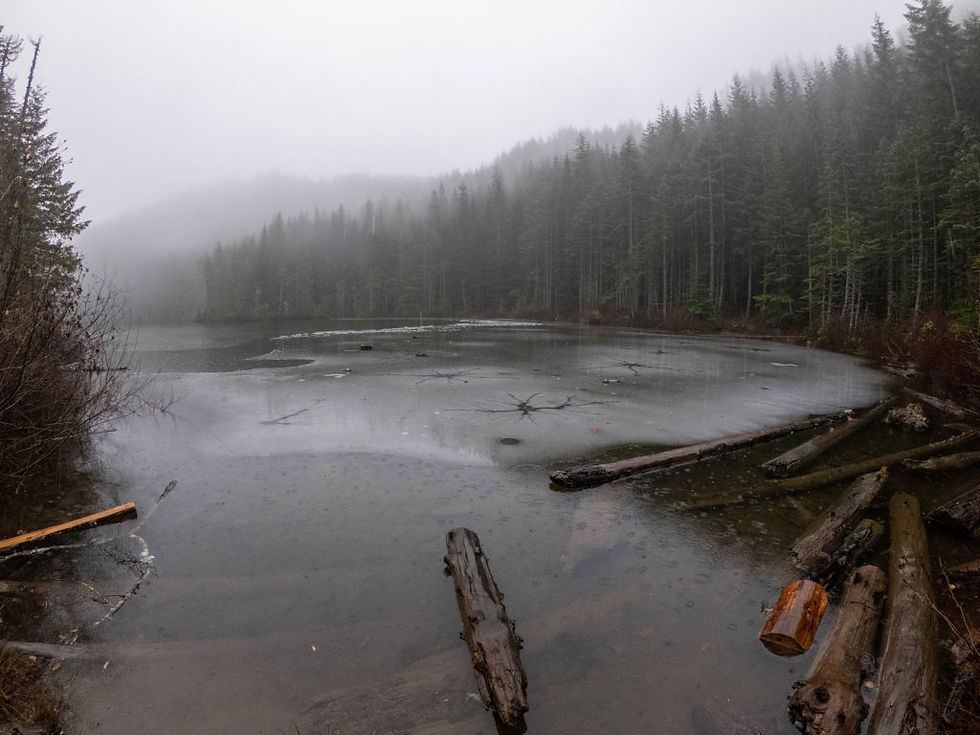
A beautiful winter hike to an ice covered high lake in Mount Hood National Forest.

Lake Name: Memaloose Lake Lake Coordinates: 45.0978, -122.2366 Lake Elevation: 4080′ Access: Trail Distance: 2.9 miles (round trip)
Elevation Range: 3568' to 4170'
Ascent/Descent: +723 ft / -705 ft Trail Type: In and out
Trail: Memaloose Lake Trail #515
Permits & Fees: None Note: There are 4 small stream crossings. There is a detour driving route due to a road closure. *You will want to use a map or some form of navigation to drive to the trailhead.
Location: Near Forest Road 45 in Mount Hood National Forest, Oregon, U.S.A.
Administration: Mount Hood National Forest
Ranger District: Clackamas River Ranger District Date accessed: 12-14-19
It was quite the drive to get to the trailhead. It was 23 miles on forest service roads. The last section before the trailhead we drove in the snow. The trailhead was well marked and easy to spot if you’re looking for it. From the direction we came, the trailhead was on the right side of the road. On the first section of the trail there were patches of snow, but the further up we got the more snow there was on the trail until it coated the whole thing.


Once we reached the switchbacks there was a solid 2″ of snow that covered everything. The snow was fresh and powdery. No one had been on the trail recently, so it was just a spotless blanket on our way to the lake.
The first part of the trail was gradually uphill then towards the end the switchbacks climbed quickly to the top of the hill. There were 5 switchback corners. Throughout the entire trail there were a total of 4 easy stream crossings. Once we reached the lake I was somewhat shocked to find that it was totally frozen over. I thought some of it might be frozen, but not the whole thing! It was so beautiful. It was my first frozen lake hike this winter. The hike was very straight forward and the trail was easy to follow even with snow.

Resources
How to get there
Reference the Forest Service for directions. Follow detour route specified on the Forest Service website. Note the main route is closed. A map is useful for navigating to the trailhead.
Location
Lake Coordinates: 45.0978, -122.2366
Clackamas River Ranger District map location: T5S R5E S31
Maps
My Wild Adventure is not responsible for your safety, any possible injury, or anything that happens if you choose to follow anything on this website. Maps are not intended to be used for navigational purposes, but to give an overview of the route taken. By going outdoors you are solely responsible to know your strengths and limitations, be aware of current conditions and proceed with the appropriate caution. My Wild Adventure is not responsible for your choices and the outcome. Reference my disclaimer for more information on being responsible outdoors.