Highway 224 & the Upper Clackamas River - Part 7
- Tina McLain
- Sep 1, 2025
- 7 min read

A break down of all viewpoints, river access points, seasonal waterfalls, and hikes along the Clackamas River from the Narrows to Sandstone Boat Access Site.

Part 7 explores seven pull-offs, two creeks, and one view. All are within the national forest.
For more information on activity ideas, resources, safety, and a list of each place by category check out my Highway 224 & Upper Clackamas River - Overview post.
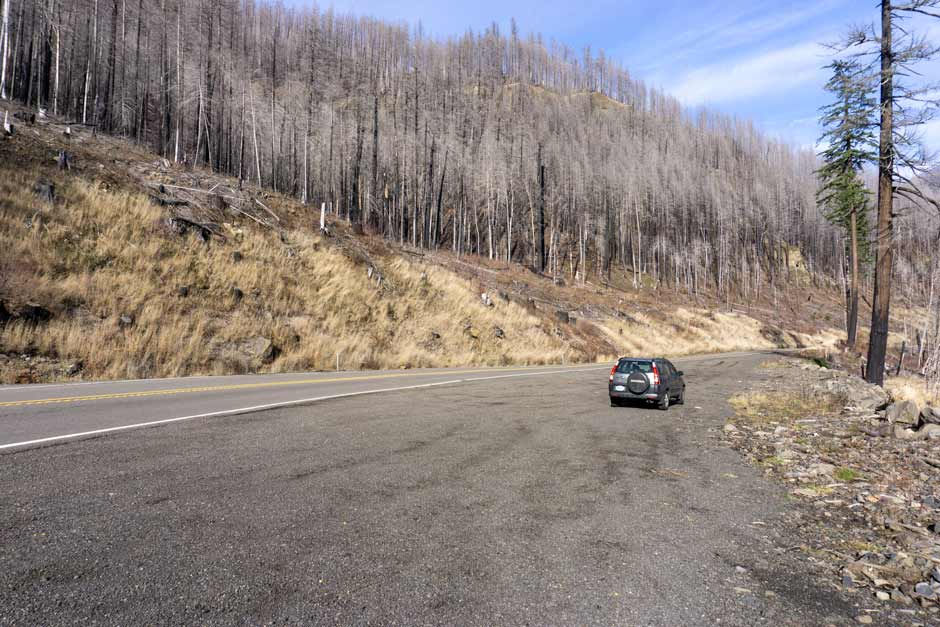
Recreating in Burned Areas
The majority of the Upper Clackamas River was affected by the 2020 fires. Large amounts of the area have reopened as of 2025. There are still a few areas/roads that are closed to public access.
As I’ve noted above, the majority of the Upper Clackamas River was affected by the 2020 fires. Large amounts of the area have reopened as of 2025. There are still a few areas/roads that are closed to public access.
As with any aspect of recreating outdoors, it’s important to make sure what you’re doing is legally open to the public. For up-to-date information on what is open, check out the Mount Hood National Forest website.
Another important aspect to consider when recreating in burned areas is the additional hazards and risks, such as unstable slopes/ground, flash floods, potential for falling trees/limbs, etc.
I really encourage everyone to check out the forest service page, “Safety in Burned Areas,” which discusses how to stay safe in burned areas.
Seasonal Waterfalls Disclaimer
I designate “waterfall” as any amount of water that flows or drops a vertical (or mostly vertical) rock surface. I use the word waterfall rather loosely, and I don’t use any official parameters for what is designated a “waterfall.” Basically if it appears to be falling water, I label it as a “waterfall” for ease of use.
There are a plethora of seasonal waterfalls along the upper Clackamas River. There's no way I could note all of them. So, I'm going to focus on marking those that are 1) most visible from along Highway 224, and 2) the most noticeable/my favorite ones. There are still plenty that I haven’t noted in this post. There are two that I know of that I didn’t add due to it not really being possible to photograph them. So, keep your eyes peeled for waterfalls along the way.
Some are best seen driving a particular direction (east vs. west), so I'll make sure to note which direction has the best visibility when discussing the waterfalls.
Winter/spring is usually the best time to see the waterfalls, particularly after some consistent/heavy rain. There is no guarantee the waterfalls listed will be present at different days/times of year. For the most luck in seeing waterfalls, it’s best to go after there’s been some heavy/prolonged rain along with snow melt.
All seasonal waterfalls are approximate coordinates, it gives the idea of where the waterfall is, but there is room for error on my part.
Pull-offs Disclaimer
I note a majority of the pull-offs along Highway 224, but there are some I’m sure I didn’t cover. It’s as close to being comprehensive as I could get. There is some subjectivity involved as to what constitutes a “pull-off.” So there are some areas others might consider pull-offs that I didn’t note.
There are some pull-offs that have boot paths leading to the river or river views, which I do my best to mention. Most of the photos I took are of the pull-off’s themselves since it is easier to eye that if you go driving yourself. Some places I included pictures of the river, but not in all. I think part of the fun with this list is going to those coordinates and seeing for yourself what it looks like.
Explore the map below to see where each place discussed is located.
Quick Reference

Pull-off 45.13810, -122.08294
Coordinates: 45.13810, -122.08294
Use: Sitting in car
River (access, view, none): None
Parking: Room for at least 6 cars
Note: Doesn't have access to the river or really any views.
Easiest driving direction for access: West (towards Estacada)
This pull-off is on the east side of highway 244. It used to have a view of a really pretty creek, but the creek is obscured by a large amount of trees post-fire. Its now just a nice place to pull off, not really a place for a view of anything.

Pull-off 45.13583, -122.08102
Coordinates: 45.13583, -122.08102
Use: Sitting in car and (okay) view of river
River (access, view, none): View
Parking: Room for a couple of cars
Easiest driving direction for access: East (towards Ripplebrook)
This pull off is on the south side of highway 224. There are some huge boulders lining the edge of a drop off that drops down to the Clackamas River below. This isn’t really a river access point, or even that great of a view. It’s probably best for a quick stop or just stopping in your vehicle.

Deer Creek
Coordinates: 45.13305, -122.07786
Seasonal or Year-Round: Year-round
Visible From: Highway 224
Best Seen Driving: East (towards Ripplebrook), but can be seen driving both directions
Deer Creek is on the east side of highway 224. It’s hard to miss. It is almost a waterfall where it comes out next to the road, but I’m going with classifying it as a creek since 1) it’s named and 2) the slope doesn’t seem quite steep enough. It’s rather pretty and has a decent flow rate year round for the size of creek it is. There isn't really any place to stop next to it, but it's easy to see when driving past.

Pull-off 45.12920, -122.07856
Coordinates: 45.12920, -122.07856
Boot path (approx.) coordinates: 45.12924, -122.07856
Use: Parking, sitting in car, boot path to river view
River (access, view, none): View
Parking: Room for many vehicles
Easiest driving direction for access: East (toward Ripplebrook)
Right past the turn off for Three Lynx are multiple make-shift pullouts along both sides of the highway. They’re a place to stop briefly or let people pass, none really have any views except for this pull off along the west side of the road which has boot paths to river views.
The west side of the road doesn’t have any river access even though there are boot paths, but they go to the end of a steep embankment that drops straight down to the river and is eroding. So while walking down the boot path can take you to a view of the river, it doesn’t take you to the “edge” of the river.

Pull off 45.12889, -122.07850
Coordinates: 45.12889, -122.07850
Use: Sitting in car or letting other cars pass
River (access, view, none): None
Parking: Room for a large amount of cars to park
Easiest driving direction for access: West (towards Estacada)
Along the east side of the highway is a huge pull-off that is great for letting people pass or just stopping for a moment to be in your car.

Bridge 45.12569, -122.07814
Coordinates: 45.12569, -122.07814
Best Seen: Driving on Highway 224 and can be seen from pull-off 45.12475, -122.07718
I'm unsure of this bridge's name. I even tried looking on old/historic forest service maps and couldn't find anything. So I'll just reference it based off of its coordinates. This bridge is on Highway 224 and crosses the Clackamas River. It's between the turn off for Three Lynx and Sandstone Boat Access Site.

Pull-off 45.12475, -122.07718
Coordinates: 45.12475, -122.07718
Use: View of bridge & river
Activity: Short hike
Distance: 0.30 miles (round trip)
River (access, view, none): View
Facilities: None
Parking: There is room for a couple cars.
Note: Start of "trail" 45.12478, -122.07729. End of "trail" 45.12545, -122.07931.
Easiest driving direction for access: East (towards Ripplebrook)
Other Posts: For more detailed information check out my post on Hike From Pull-off 45.12475, -122.07718.
This pull-off is on the south side of bridge 45.12569, -122.07814, on the southwest side of highway 224. It’s not a huge pullout and has a burm blocking an old road/path. It's one of the only places that you can stop to see the bridge. There is a foot path that goes beyond the burm which is within a heavily burned area. It goes for about 0.15 miles before ending at an edge of a creek. It has good views of the bridge and river at the end.

Pull-off 45.12487, -122.07516
Coordinates: 45.12487, -122.07516
Use: Parking or sitting in car. View of river and Three Lynx Creek.
River (access, view, none): View
Facilities: None
Parking: Room for at least 6 cars
Easiest driving direction for access: West (towards Estacada)
This pull of along the north side of highway 224. It’s more of a wide shoulder. It doesn’t really have access to anything, but it does have pretty views of the river and of Three Lynx Creek that feeds into the river from the north side. It’s a descent size pull off and is more long than it is wide.

Pull-off 45.11678, -122.07558
Coordinates: 45.11678, -122.07558
Use/To See: Parking, view of river
River (access, view, none): View
Facilities: None
Parking: Pre-landslide there was room for numerous amounts of cars, now it's more limited.
Note: This pull-off was affected by a landslide in Feb/Mar of 2025.
Easiest driving direction for access: West (towards Estacada), but can be accessed driving either direction.
This pull-off is huge and graveled. It’s on the east side of the road right before Bridge 45.11621, -122.07515 and the turn off for Forest Road 4620. It has views of the river and bridge. There's a very rocky loose embankment that lines the pull-off and drops down to the river, so going just a little bit further to Sandstone Boat Access Site is better for river access.


Creek 45.11643, -122.07587
Coordinates: 45.11643, -122.07587
River (access, view, none): None
Note: This creek was also affected by the landslide that happened in Feb/Mar 2025, so it looks a little different, but is still visible and pretty (in my opinion).
Easiest driving direction for access: East (towards Ripplebrook)
This creek is right at the junction for FS 4620. It’s on the west side of highway 224 and FS 4620 where they meet. During the winter, when it’s cold enough it can get icy and it looks really pretty. It’s a year round creek that flows into the Clackamas river. I couldn’t find a name for the creek referenced on any of the maps I looked at, so I'm just referencing it by it's coordinates.
My Wild Adventure is not responsible for your safety, any possible injury, or anything that happens if you choose to follow anything on this website. Maps are not intended to be used for navigational purposes, but to give an overview of the route taken. By going outdoors you are solely responsible to know your strengths and limitations, be aware of current conditions and proceed with the appropriate caution. My Wild Adventure is not responsible for your choices and the outcome. Reference my disclaimer for more information on being responsible outdoors.


