Faraday Lake
- Tina McLain
- Oct 6, 2025
- 4 min read

A reservoir for fishing along the Clackamas River near Estacada.

Lake Name: Faraday Lake
Lake Coordinates: 45.26546, -122.31659
Lake Elevation: 527'
Access: Trail
Distance: 3.72 miles (round trip)
Elevation Range: 506' to 571'
Ascent/Descent: +65 ft/-57 ft
Trail Type: In and out
Route: Gravel trails and PGE roads
Outing Type: Day hike and/or fishing
Winter Activity Options: Open year-round
Fees: None
Note: There is a variety of different ways to "hike" this area. It can be as short or long as you want, up to 3.75 miles.
Location: Near Estacada, Oregon along Faraday Road.
Managed By: PGE - Portland General Electric
Date Accessed: July 26, 2025
Faraday Lake is a stocked reservoir managed by PGE. It reopened recently after having been closed for a while due to construction.
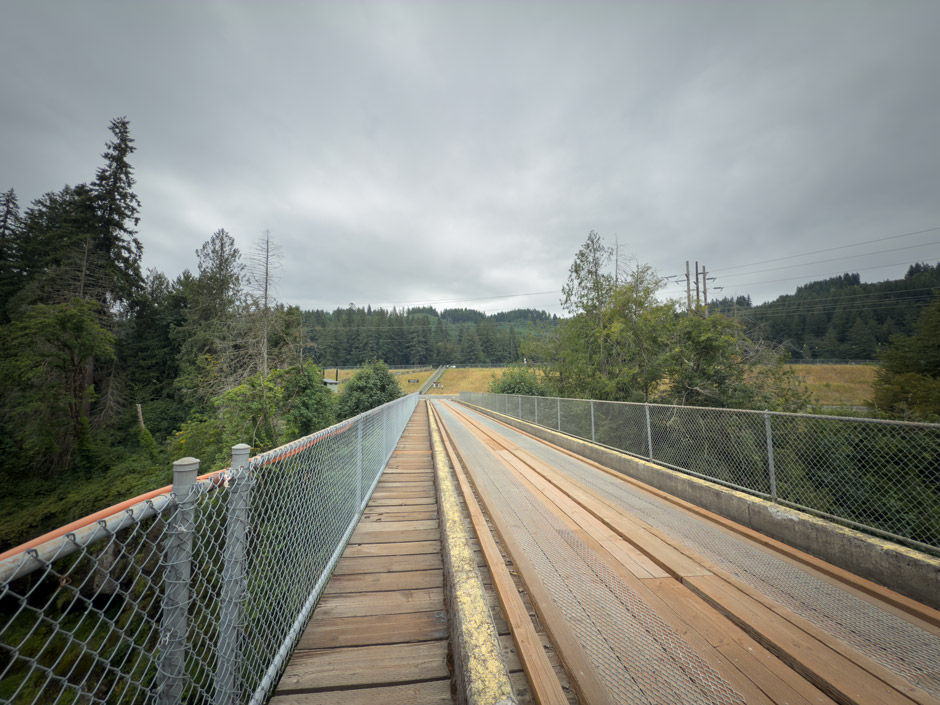
There is a decent amount of parking spots in the parking area and I have yet to see it completely full. The parking lot is located within a chain-link fenced area and right next to the bridge that is used to access the lake by hiking.

The bridge goes over the Clackamas river and is gated so only pedestrians and PGE vehicles can cross the bridge. On the other side of the bridge is an outhouse and a gravel road that travels west and east roughly. There are some stairs and a wheel chair accessible ramp that goes uphill to the lake.

After getting to the top, the lake is visible. To the west is Faraday Dam and to the east is the gravel trails that travel along the edge of the lake. There's even an information sign at the top of the stairs.

There are numerous gravel trails/roads that are hike-able, as well as a path along the dam. To the east along the gravel trail are some picnic tables, then there are 3 graveled fishing pads along the lake.
I've been fishing at this lake multiple times and it is mainly a fishing spot which makes for less foot traffic when hiking. The lake is stocked by the ODFW with rainbow trout.

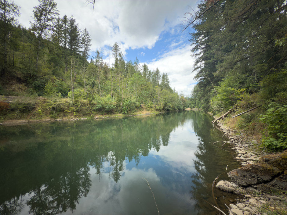
One Saturday I decided to go out with my Dad and hike all the roads/trails near Faraday Lake. We hiked along the lakes edge and past the concrete fishing pads then continued up Kelly Road which eventually crossed another bridge. The lake was rather narrow in this section and really had a canal kind of look to it.

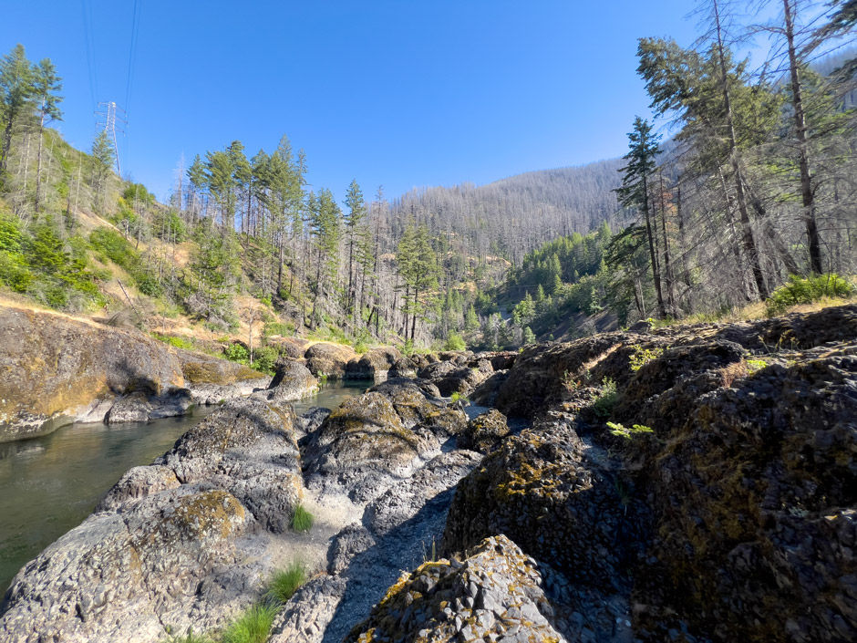
After crossing the bridge, the road traveled along the south side of Faraday Lake until the lakes end. It was beautiful through this section. After the lake ended, the road continued and followed along the Clackamas River from about 150 ft above it. The road ended once it reached a gate near what I call the "overflow dam." I'm not sure what this dam is named, but it's also visible from the Cazadero/Old Clackamas Highway Trail that's on the north side of the river. It was cool to get to see it from the south side for the first time. We could see where the fish latter starts which was pretty cool.

We then turned around and headed back the way we came. The forest through this section was very dense with underbrush and a vibrant green.
We decided to hike along the top of the dam, since I hadn't explored it yet. There were a few fisherman fishing from it. Once we reached the end of the walkway we were able to see the powerhouse below and a little bit down the Clackamas River. We were able to see some kayakers in the river. We had a bald eagle fly right over us at one point.

We headed back to the car and clocked in 3.7 miles total. For being a reservoir, I find the whole area to be rather pretty and enjoyable to recreate in.
From the parking lot:
0.15 miles to top of stairs along Faraday Lake
0.4 miles to end of Faraday Dam
0.35 miles to fishing piers along "canal"
0.8 miles to bridge over Faraday Lake
1.1 miles to end of Faraday Lake
1.5 miles to overflow dam
Resources
"Stocked 25-acres reservoir provides year-round fishing. Only bank fishing is allowed - no boats, rafts, tubes."
"Fish species: rainbow trout, steelhead"
Coordinates
Parking lot: 45.26809, -122.31425
Bridge across Clackamas River: 45.26734, -122.31425
Outhouse: 45.26658, -122.31424
Stairs/Wheel chair ramp: 45.26648, -122.31426
Information sign: 45.26635, -122.31437
End of walking area on Faraday Dam: 45.26734, -122.32005
Faraday Dam: 45.26755, -122.32096
Graveled fishing pad #1: 45.26456, -122.31153
Graveled fishing pad #2: 45.26431, -122.31082
Graveled fishing pad #3: 45.26405, -122.31027
Where trail and Kelly Rd intersect past fishing pads: 45.26318, -122.30783
Bridge over Faraday Lake: 45.26154, -122.30335
End of Faraday Lake: 45.25835, -122.29972
End of Kelly Rd (near Overflow Dam): 45.25266, -122.29873
Overflow dam: 45.25189, -122.29848
How to get there (from Estacada, OR)
Take Highway 224-E out of Estacada for 1.3 miles. Turn right on SE Faraday Rd and proceed for 0.3 miles. Turn right into the parking area for Faraday Lake.
Map
My Wild Adventure is not responsible for your safety, any possible injury, or anything that happens if you choose to follow anything on this website. Maps are not intended to be used for navigational purposes, but to give an overview of the route taken. By going outdoors you are solely responsible to know your strengths and limitations, be aware of current conditions and proceed with the appropriate caution. My Wild Adventure is not responsible for your choices and the outcome. Reference my disclaimer for more information on being responsible outdoors.