Dinger Lake (no bushwhacking)
- Tina McLain
- Dec 29, 2025
- 4 min read

A hike to a quiet lake in Mount Hood National Forest.

Lake Name: Dinger Lake
Lake Coordinates: 45.1457, -121.8441
Lake Elevation: 4000′
Access: Road walk/unnamed "trail"
Distance: 1.16 miles (round trip) *I ended up hiking a total of 1.56 miles since I tried going down the other road that dead ended. Elevation Range: 3957' to 4109'
Ascent/Descent: +155 ft/-129 ft
Route Type: In and out
Route: Walking down an unnamed/unmarked "road"
Outing Type: Day hike
Permits/Fees: None
Note: Five years ago I accessed this lake via bushwhacking. This "road" is by far the easiest route to access the lake and requires no bushwhacking.
Location: Near Timothy Lake in Mount Hood National Forest, Oregon, U.S.A.
Administration: Mount Hood National Forest
Ranger District: Clackamas River Ranger District
Other Posts: Dinger Lake
Date Accessed: June 18, 2020

Five years ago, I bushwhacked to Dinger Lake via the west side of the lake from FS-025. Recently, I saw that AllTrails had a route to the lake from a different approach, I was highly skeptical since there are a few "trails" in the area AllTrails have on there where there are no trails such as Wolf Peak (which was a fun bushwhack but there seriously is no trail and people should be aware of that). I decided to just scout it out and see what it was.

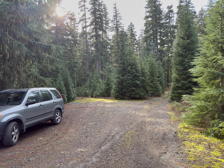
It required driving down some one lane gravel roads with encroaching trees on either side. I stopped and parked at 45.14942, -121.83325 where there was a V in the road and it obviously started to appear more overgrown. I hadn't saved the route AllTrails had, but did have downloaded maps of the area. So I just winged it. I tried going down the road to the left (south) first which dead ended at 0.20 miles. There was no apparent trail continuing beyond the roads end. It would require bushwhacking, probably a BW1 or 2 roughly.

I turned around and headed back to my car. There were some downed trees and mushrooms in the road that were fun to take pictures of. Got a nice extra 0.40 miles.

I then headed down the road to the right (southwest). It appeared someone had tried driving down it in the past month, but I'd recommend hiking over driving since just a little ways down there was a huge downed tree across the road. The road gradually went downhill. The forest was pretty — it was wide and open in certain parts. I got to see some cool mushrooms and water droplets on pine needles.

The road was a bit washed out farther down and slowly got narrower. It eventually flattened out. The last 700 ft to the lake was more like a wide dirt path than a road. It took me right to the lake's edge! I was in awe. I was actually able to see the water and touch it. When I last tried to access this lake in 2020 via a different route bushwhacking I could only make out the water far away.

It was so cool for the water to be right there this time. It was really beautiful with yellow grass. There isn't a trail all around the lake and the AllTrail "route" would require bushwhacking/navigating. I am a bit confused still as to why AllTrails has this on their site since it isn't an established trail or even a popular non-trail route.

I hiked back the way I came to my car. It was an enjoyable outing and I didn't see anyone else while I was out. My only companions were the occasional bird, chipmunk, or squirrel.

Resources
AllTrails (there isn't a trail the whole way around the lake)
Coordinates
Where I parked: 45.14942, -121.83325
Alternate parking (park here instead if you don't want branches lightly touching your car): 45.15143, -121.83190
Road that DOESN'T lead to the lake: 45.14919, -121.83347
Where 1st road dead ends: 45.14710, -121.83472
Road towards Dinger Lake: 45.14935, -121.83354
Downed tree: 45.14829, -121.83617
Lake's edge: 45.14813, -121.84234
Dinger Lake: 45.1457, -121.8441
How to get there (from NF-58)
NF-58 and NF-5860 intersect at 45.17775, -121.80217. Take NF-5860 for 1.3 miles. Turn right onto NF-240 (at 45.16139, -121.81436) proceed for 1.47 miles until the road V's and park at 45.14942, -121.83325.
Map
My Wild Adventure is not responsible for your safety, any possible injury, or anything that happens if you choose to follow anything on this website. Maps are not intended to be used for navigational purposes, but to give an overview of the route taken. By going outdoors you are solely responsible to know your strengths and limitations, be aware of current conditions, and proceed with the appropriate caution. My Wild Adventure is not responsible for your choices and the outcome. Reference my disclaimer for more information on being responsible outdoors.


