Warren Lake & Mount Defiance
- Tina McLain
- Apr 10, 2023
- 5 min read

Updated: Jun 18, 2024
A hike to a lake and peak in a pieced together hiking loop in Mount Hood National Forest.

Main points on route: Warren Lake & Mt. Defiance
Lake Name: Warren Lake
Lake Coordinates: 45.6561, -121.7053
Lake Elevation: 3750'
Peak Name: Mt. Defiance
Peak Coordinates: 45.648496, -121.722553
Peak Elevation: 4960'
Access: Trail & Road Walk
Route Type: Loop
Distance: 4 miles (round trip)
Elevation Range: 3731' to 4961'
Ascent/Descent: +1223' / -1180'
Trails/Roads: Warren Lake Trail #417 A, Mitchell Point Trail #417, Mt. Defiance Trail #413, Mt. Defiance Summit Trail #413 B, Mt. Defiance Road
Permits/Fees: If entering the Mark O. Hatfield wilderness boundary, you need to fill out a free, self-issue wilderness permit.
Note: There are two main ways to access Mt. Defiance, either via Warren Lake Trailhead out of Dee, OR or via the Mt. Defiance Trail #413 which starts in the Columbia River Gorge.
Location: In Mount Hood National Forest near Dee, Oregon, U.S.A.
Administration: Mount Hood National Forest
Ranger District: Hood River Ranger District
Date Accessed: September 25, 2021

It was my third attempt at reaching the Warren Lake Trailhead. Over the previous year I had tried two other times, but snow stopped me from getting close enough to the trailhead to hike. So I waited until the end of the summer/start of fall to attempt this hike again.
I brought my mom and dad along for the hike. We ended up starting out in the afternoon, anticipating it might be around approximately a 3-mile loop and we should easily be done before sunset. The drive to the trailhead was uneventful and there were a few vehicles already parked.


The trailhead was well marked and we decided to go to Warren Lake then loop up to Mt. Defiance and then road walked back to the trailhead. We came across a few people on our way to the lake, and there were some people camping near it. The Warren Lake Trail #417 A was pretty flat until it's junction with the Mitchell Point Trail #417 which is where the wilderness boundary for the Mark O. Hatfield Wilderness starts. The Mitchell Point Trail descends gradually downhill to the lake. Warren Lake was a decent sized lake for the area. The trail followed closely along one side and there were multiple spots we could access the lake's edge. All the deciduous trees were full of fall colors. There were lots of red leaves. The trail started to climb rapidly uphill through a rock field and there were lots of switchbacks. I ended up going off trail to pee at one point and found an incredible view of the gorge on a rocky ridge.


The trail from the lake up to the Mt. Defiance summit felt like an intense climb. I struggled with being lightheaded due to lack of nutrition over the past month. I was really thankful I didn't attempt to do this hike alone with how my body was responding. I was beyond fatigued and exhausted. We kept going at slower pace, and I had to take occasional breaks.


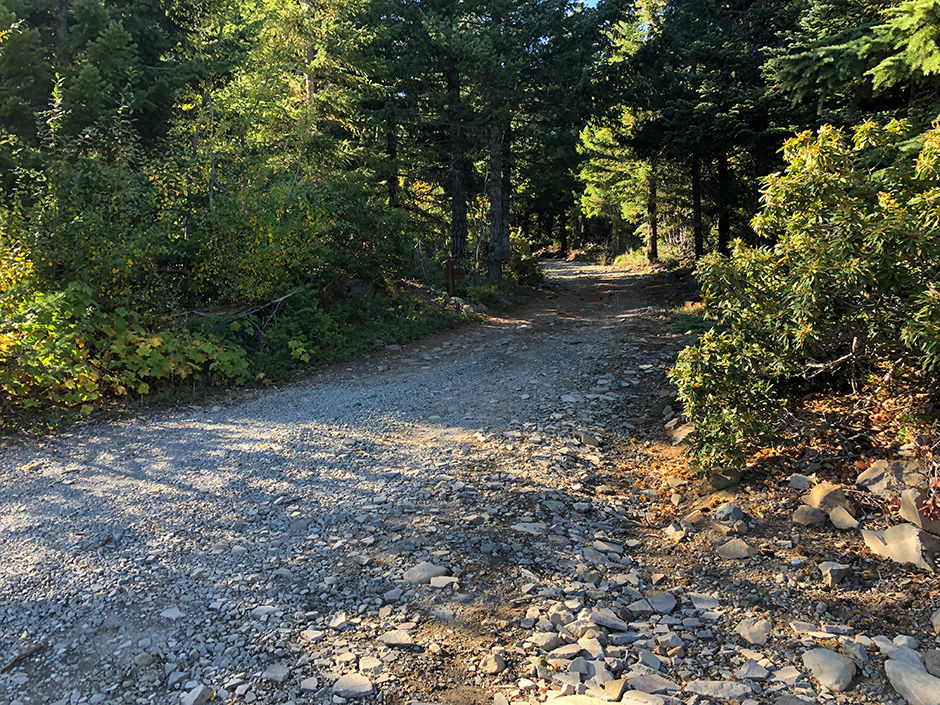
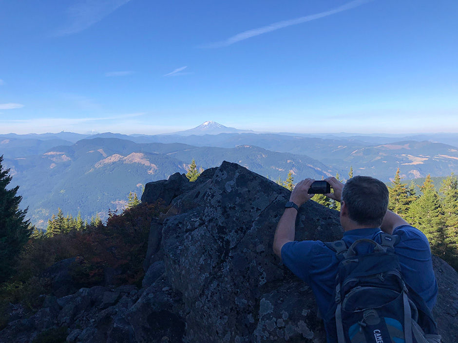
The Mitchell Point Trail #417 met up with the Mt. Defiance Trail #413 which we followed until it split, and we continued on the Mt. Defiance Summit Trail #413 B to the peak. The last few hundred feet we just followed the road up to the peak which had incredible views of Mt. Hood. The peak had a cellphone tower on it and there were only views from the side edges. We found another viewpoint area where we could see Mt. St. Helens. I wouldn't consider this summit a "pretty" one, but the views from the spots I found along the edge were great. It was getting closer to sunset, so we started the road walk down Mt. Defiance Road back to where we parked. The road had some steep sections with larger gravel and rock slabs that caused my mom to slip and fall twice. The road was all downhill back to our car. We got back as dusk was starting to set in and all felt rather accomplished. It ended up coming in at 4 miles doing the loop, not the 3 miles I'd estimated. We drove to Hood River to get Subway sandwiches for a late supper.
Overall it was a good and challenging hike. The challenging part was doubly so due to health issues I'd been experiencing that made it difficult for me to eat much of anything. It can be frustrating sometimes how much living with a chronic illness that is ever changing can effect the things I'm wanting to do such as getting outdoors and hiking. This was my last hike of the year, which I didn't anticipate at the time. Things continued to decline for me over the following months until I had surgery in December 2021 which helped somewhat with some of the issues I'd been experiencing. It took a good 6 months to get back to the point I could tolerate eating food in a way that wasn't restrictive.


It's almost December 2022 when I'm writing this and it's been a struggle to do much outdoors this year. I'm hoping I have higher energy levels and am able to manage things so I can get outdoors more in 2023, but only time will tell. Listening to my body and wanting to listen to it are two completely different things. I know I've done what I've needed to over this past year in not doing much outdoors because my body can't handle it, but at the same time I don't want to listen to it and I just want to do the things I want to do. It's a sad reality of the continual grieving process chronic illness causes. Honestly, there is no "positive" note I'm going to end on because it's okay to sit in these kind of emotions. Chronic illness sucks and effects tons of things. It can be limiting and frustrating when I can't do the things I want to do and that's okay.


Hiking Mileage
Trailhead to Warren Lake shore @ mile 0.8
First crossing on Defiance Summit Trail of Mt. Defiance Road @ mile 1.96
Summit @ mile 2.3
Start of road walk back to parking area @ mile 2.8
Finish loop at parking area @ mile 4
Hiking Coordinates
Start of trail - Warren Lake Trailhead: 45.65111, -121.69692
Warren Lake Trail #417A crosses FS 2821-630: 45.65579, -121.69742
Wilderness Permit Box (Warren Lake Trail #417A intersects with Mitchell Point Trail #417): 45.65601, -121.69829
Side trail to Warren Lake: 45.65593, -121.70368
Lake edge access #1: 45.65568, -121.70427
Lake edge access #2: 45.65672, -121.70511
Awesome off-trail view of gorge and mountains in Washington: 45.65853, -121.70703
Mitchell Point Trail #417 intersects with Mt. Defiance Trail #413: 45.65540, -121.71564
Start of Mt. Defiance summit trail: 45.65238, -121.71736
View of Mt. Hood from Mt. Defiance summit: 45.64854, -121.72264
View of towards N & W - Mt. Adams & Mt. St. Helens from Mt. Defiance summit: 45.64894, -121.72306
Location
Lake Coordinates: 45.6561, -121.7053
Peak Coordinates: 45.648496, -121.722553
Hood River Ranger District map location: T2N R9E S16
Maps
My Wild Adventure is not responsible for your safety, any possible injury, or anything that happens if you choose to follow anything on this website. Maps are not intended to be used for navigational purposes, but to give an overview of the route taken. By going outdoors you are solely responsible to know your strengths and limitations, be aware of current conditions and proceed with the appropriate caution. My Wild Adventure is not responsible for your choices and the outcome. Reference my disclaimer for more information on being responsible outdoors.


